GPS DIPOLE TESTING UNIT FOR LANDFILL SURVEYS
The newest testing innovation developed by Geotest’s in-house Research and Development Program is the computer controlled GPS Dipole Testing Unit that complies with ASTM D7007. The unit has been under test for the last 18 months and is now ready for commercial applications.
The unit has been successfully employed on a number of recent projects undertaken by Geotest including land fill applications where significant coverage of drainage material was placed over the geomembrane liner, and required testing via a leak detection system to verify that no damage to the geomembrane had occurred during the covering operation.
Due to the nature of some facilities, the contained medium was not able to be removed or is part of the construction and traditional leak detection testing methods have proven ineffective. With our new Computer controlled GPS Dipole testing unit, we are able to utilise our newly developed technology to complete the survey safely without compromising the site.
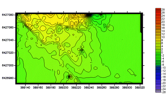
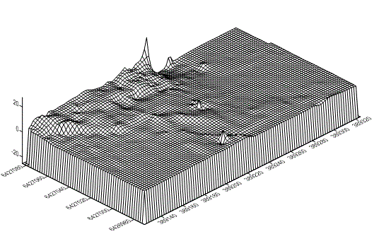
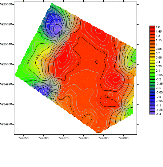
This method utilises new testing methods associated with ASTM D7007 in addition with a GPS, meaning the survey can be conducted in multiple dimensional planes to effectively map readings over the area and accurately identify suspected defects. We successfully located voids in areas beneath the drainage material in several locations, leading to the repair and restoration of the integrity of the liner. By recording the data from the dipole filtering and analysing it through a computer program, the entire survey area was mapped in three dimensions to provide a full visual representation of the concerns identified.
METHOD OF USE
As with the traditional ASTM 7007 dipole method, a high voltage DC power source is applied to the medium above the geomembrane and grounded to the earthing system underneath.
Measurements of voltage potential are measured by the equipment in two dimensions as the device moves across the drainage medium. The data is recorded with high clarity using a sophisticated GPS mapping system in real time as the survey occurs. Once complete, the data is fully analysed, refined and mapped onto a three dimensional contour graph, giving exact locations and expected severity of any concerns identified. This allows full provision of quality assurance documentation to the client and additional survey oversight for full confidence of the installation integrity.
SUMMARY
The Geotest GPS mapping dipole can be used in circumstances where a covering material cannot be removed or to verify no damage has occurred as part of construction. This survey technology provides an option to clients that are faced with geomembrane integrity concerns for an installation that is currently in service or the contained medium can’t be removed or is part of the construction where traditional leak detection methods have proven ineffective. By using the GPS computer generated system, full confidence can be obtained for suspect areas with visual representation of the anomalies mapped in three dimension for analysis.


